Sometimes archaeology fleshes out history allowing us to touch, feel and interact with historic objects and features. But sometimes the relationship goes the other way, with history allowing us to associate people and events with historic objects and features. Sometimes history allows us to identify important archaeological sites and sometimes, following the discovery of a new archaeological site, significant, related, historical records come to light.

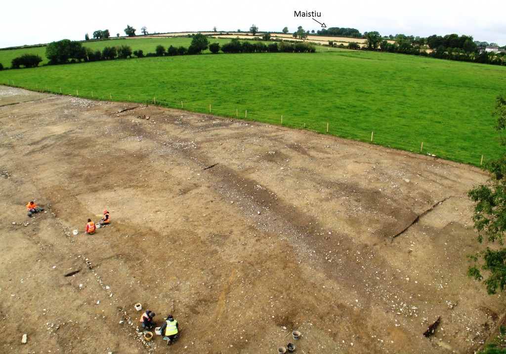
As part of the archaeological investigations in advance of the N9/N10 scheme in county Kildare, archaeological excavation was undertaken in the townland of Mullamast on behalf of the National Roads Authority and Kildare County Council. The townland takes its name from the `Royal Site´ of Maistiu, an upstanding ringfort or rath, located on a ridge of high ground to the west of the motorway route (hence Mullach Maistiu – the summit of Maistiu).
However, this is not the only archaeological site within the townland. The Down Survey map of the townland (compiled by William Petty in 1655-6) shows a `castle´ located generally to the east of the `Royal Site´ close to the current location of Prospect House. This castle did not survive much longer and its exact location is not known, as all surface remains of the site had been lost by the time the Ordnance Survey compiled their initial series of maps in the 19th century.
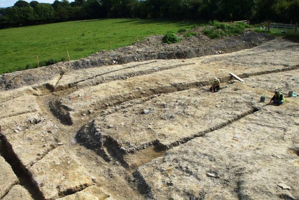
As the likely site of the castle was close to the route of the N9/N10 motorway, a lot of investigation was undertaken along this section of the route. Analysis of aerial photography and geophysical survey indicated the presence of an extensive archaeological site. This was confirmed by test excavation. As a result a large archaeological excavation was undertaken in advance of the motorway scheme, encompassing an area measuring 23,024 m². The investigations at the site uncovered multiple phases of activity ranging in date from the prehistoric period through to the post-medieval period. The main focus of activity at the site, however, dated to the later medieval period (c. AD 1200-1500), indicating that the site was occupied by a substantial medieval village settlement for most of the later medieval period. This is probably the largest excavation ever undertaken in Ireland of a deserted medieval village, though similarly sized investigations have occurred in Britain. The excavated section of the manorial village was laid out around an axial routeway (Road 1) with residential plots or `Building Compounds´ aligned on either side of Road 1. However, the features excavated form only part of the overall site; it is likely that the majority of the village remains in situ to the east and west of the motorway.

Looking for the missing `castle´ shown on the Down Survey map led to the discovery of a much larger and more complex archaeological site. The excavation of the deserted medieval village also led to further historical research to see if any records of the settlement survived.
The townland of Mullamast lies generally within the lands originally granted to the Anglo-Norman Walter de Ridelsford in the late 12th century, but is not referred to in the surviving documents relating to his estates. Interestingly the Down Survey provided the link that led to the identification of medieval references to the settlement. The `castle´ at Mullamast is listed as being in the hands of a member of the Fitzgerald family (the Earls of Kildare) in 1655-6. Reviewing the published records of the Earls of Kildare threw up references to the manorial village. The Red Book of the Earls of Kildare preserves the ‘quit claim’ of John Wolf, yielding up his property in the manor and village of Mullamast. The village is also listed in 1540 in the records of the lands confiscated from the Fitzgeralds after Silken Thomas´s revolt. Identifying early references to the site remains problematic, though a `Stephen de Molachmast´ appears in the list of witnesses to an inquisition into the holdings of William de Mohun (Moone) dating to 1282. It´s entirely probable that Stephen was an important tenant within the manorial village at Mullamast.
Though we have now found the village other questions still remain. The `castle´ shown on the Down Survey has still to be located. The medieval references to the manor do not refer to a castle, so this could well be a late addition to the manorial complex – possibly a tower house. The other key component that is missing is a church. No signs of a church were identified during the excavation and nothing in the analysis of the aerial photography or geophysical survey results suggests a location. A church would have been a typical component of a manorial settlement and, interestingly, this is supported by the historical references to the manor. Though there is no archaeological record of a church anywhere within the townland of Mullamast, `Moolaghmast´ is listed in the Ecclesiastical Taxation of Ireland (1302-6) within the Deanery of Omorthy, and later 16th century documents refer to the `parisshes and townes of Molamast and Burnechirch´. This does suggest that there was originally a church associated with the settlement.
The experience at Mullamast shows how closely related the disciplines of archaeology and history can be and how important it is to channel data and information between both. The historical references to a manorial village at Mullamast would have remained obscured if not for the excavation. Equally the identification and excavation at the deserted medieval village was precipitated by the historic records of the missing `castle´.
Pingback: Tweets that mention Lost and Found: The Rediscovery of a Deserted Medieval Village | Headlines -- Topsy.com