During the archaeological excavations which were undertaken by Rubicon Heritage Services in advance of the construction of the N22 Tralee Bypass, many fascinating sites were identified. By far the most enigmatic of these monuments was a possible ritual avenue that was uncovered in the townland of Ballingowan, which is just east of Tralee town.
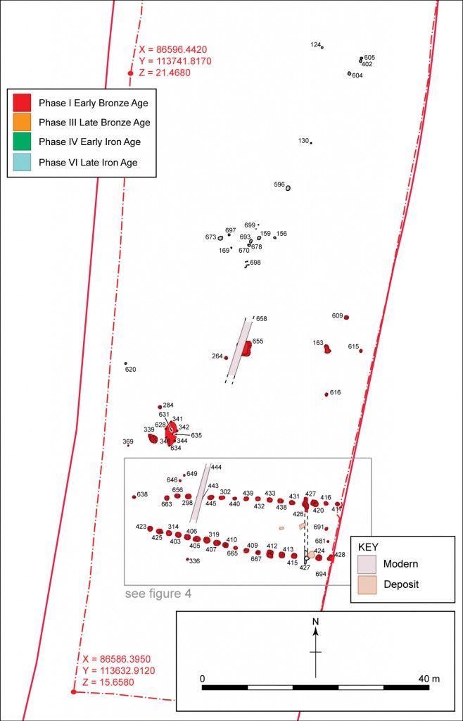
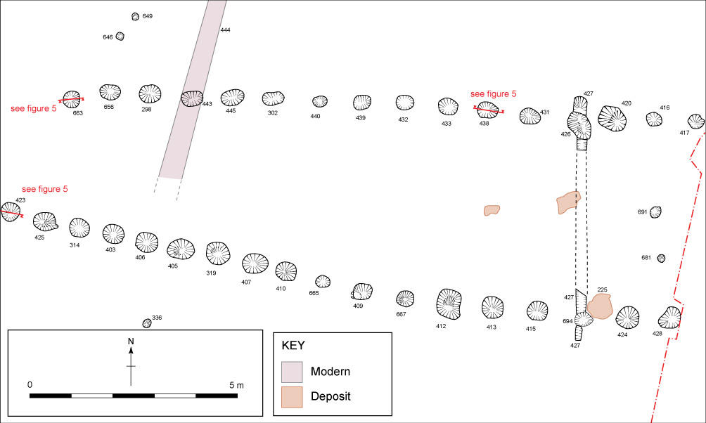
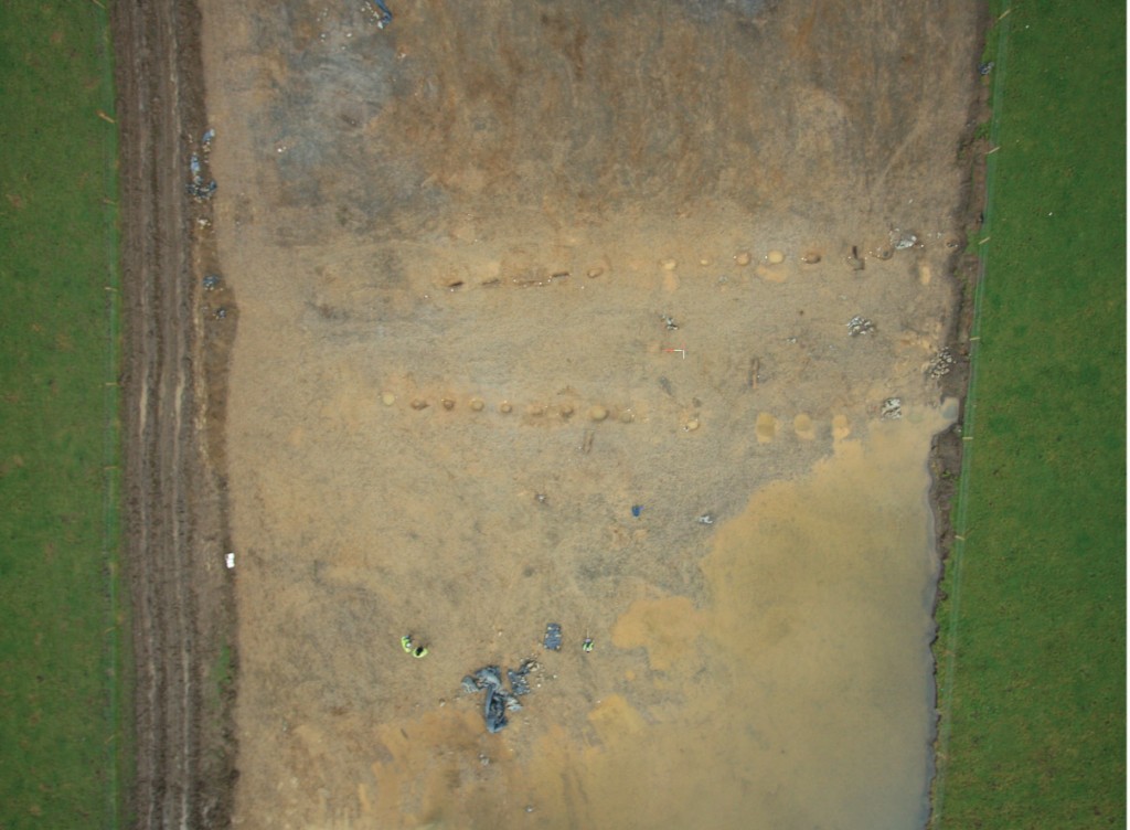
Two parallel alignments of pits which appeared to form an avenue were identified at the extreme south of the Ballingowan site on an alignment which was 80south of an east-west axis. The distance between the two rows of pits was 8.6 m at the eastern extent of excavation. It increased to a maximum of 9 m just to the west of the limit of excavation and gradually narrowed to a minimum of 5.1 m at the western end of the avenue. Within the excavation area the row was 30 m long but extended to the east beyond the road-take. A geophysical survey undertaken outside of the road corridor on the east side appeared to indicate that both alignments continued to the east. The spacing between the pits was on average 1 m (roughly a pace). No datable artefacts or material suitable for radiocarbon dating was retrieved from the pits and no comparable site has previously been identified in Ireland. These pits are likely to have functioned as post-pits, as there was evidence in a number of the features for post packing and post-pipes (marks showing where the wooden post had decayed).
- A small oval arrangement of six post-holes was located 10 m north of the avenue. The area enclosed by these features measured 4 m north/south by 1 m east/west and did not seem to have the size and shape practical for a domestic structure.
What is it?
It is difficult to find comparable Irish sites to the pit defined avenue, particularly as neither datable artefacts nor material suitable for radiocarbon dating were recovered from the post-pits. Parallel lines of pits / post-holes have been identified in association with Late Neolithic timber enclosures at Ballynahatty and Newgrange, although these were elements of complex ritual monuments whereas the Ballingowan avenue appears to be a ‘stand alone’ example. A circular enclosure at Lugg, County Dublin also had a possible avenue formed by large posts which led to the entrance of the enclosure. This has been dated to the Late Bronze Age. Circular post-built enclosures reappear as a monument type around c. 100 BC during the Iron Age and have been excavated at Site B, Navan Fort (Emain Macha), Co. Armagh; Dún Ailinne, Co. Kildare; Raffin, Co. Meath and at the Rath of the Synods, Tara, Co. Meath. However none of the above are comparable with the Ballingowan avenue.
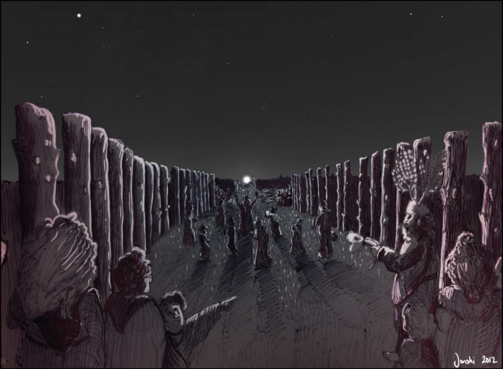
- Parallels for post-defined avenues are available in the UK. A double pit alignment was excavated in 1998-9 at Thornborough in North Yorkshire, England. Here eighty-eight pits were excavated along a 350 m length. Post-pipes and post-packing were noted in the pit fills indicating that the pits originally held upright timbers. Double pit alignments in the UK are generally dated to the Early Bronze Age and the Thornborough example was consistent with this chronology, with two radiocarbon dates in the Early Bronze Age together with lithics and pottery typical of the period. The Ballingowan avenue has many similarities to the Thornborough example. Both monuments appear to have comprised two parallel lines of posts and would have had the same visual appearance in the landscape. The alignments were similar distances apart and both curved near the terminus. The Thornborough example is the largest of four in the Ure-Swale catchment area of North Yorkshire but other examples are known elsewhere in England and also in Scotland. Avenues of this date are believed to have had a ritual function relating to processions through sacred landscapes. In Ballingowan no ritual monuments are known (so far) which would constitute such a ritual landscape. The small oval-shaped structure identified immediately to the north of the west terminus of the avenue may have been related to the activities associated with the avenue. It is believed that similar pit alignments in Cambridgeshire defined ‘vast ceremonial spaces’ related to large-scale gatherings of people during the Bronze Age. Interestingly the Cambridgeshire pit-alignments were located on the edge of a flood plain as is the case with the Ballingowan example.
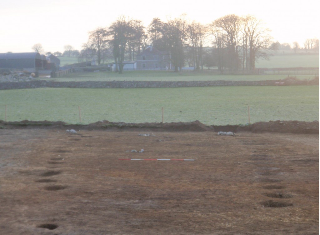
The possibility also exists that the avenue may have aligned on a celestial body at a significant time of the year. For instance the sun rises along the centre line of the avenue on the 21st March and in September the Sun, Moon and Mercury all break the horizon at this point around the 16thday of the month. The moon would have risen at this point on the horizon on the 1st November at the beginning of the second millennium BC which is an important date in the pastoralist calendar. This point marked the end of the grazing season when flocks and herds were brought together and animals that could not be maintained through the winter months were slaughtered and consumed through feasting.
- Taking all the available evidence it would seem that the Ballingowan avenue is morphologically similar to a number of Early Bronze Age British examples. This would suggest that a hitherto unrecognised prehistoric sacred landscape may survive to the east of Tralee, elements of which may still be detectable through further archaeological investigation.

