In our latest blog, Rubicon’s Jonathan Millar describes the techniques we used on a recent project to record a Georgian building in Inverness. Rubicon were in the Highland capital to carry out work for Stuart Farrell on behalf of William Gray Construction Ltd.
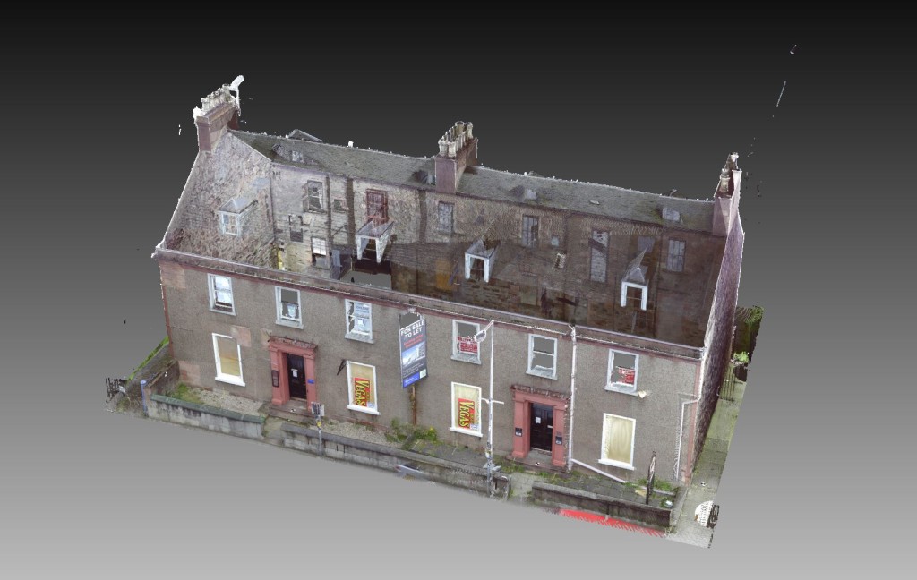
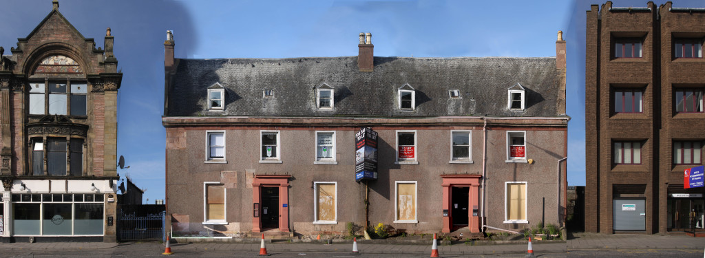
Rubicon recently undertook a photogrammetry and instrument survey of a large Georgian townhouse on Academy Street, Inverness as part of ongoing works prior to development of the site.
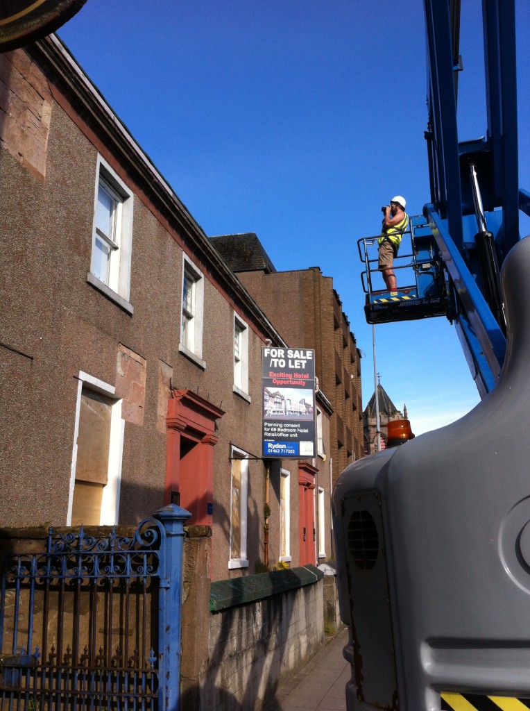
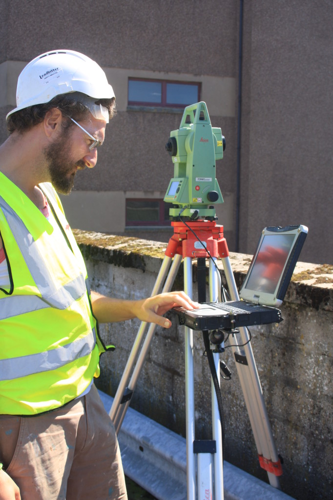
Louise Baker and I carried out the survey over the course of two sunny days in June. The photogrammetry process requires the creation of a wireframe model of the principal structural features using a Total Station Theodolite, and a comprehensive photographic survey of the exterior elevations of the structure. A cherry picker was employed to get undistorted images of the three-storey building frontage from an elevated vantage point.
Off site and back in the office, the survey and photographic images were combined digitally using a mixture of AutoCAD, Adobe Photoshop and Adobe Illustrator to create ‘rectified’ (geometrically accurate and scaled) images of each face of the building. In many instances, these rectified images are used to create stone-by-stone elevation illustrations, to facilitate interpretation of the structural phases recorded in the fabric of a building. This level of recording was not considered necessary for the Academy Street property, but is a process we have employed frequently on other projects.

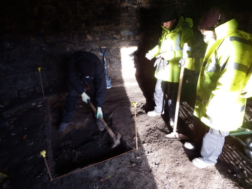
Photogrammetry is not used as frequently as it once was, mainly due to the increased availability and economy of 3D laser-scanning. The two techniques do complement each other however, and undertaking both methods of survey on the same property can provide a fuller understanding and more detailed record of the structure. In addition to the photo-rectification, a 3D laser scan was made of the building, along with a full structural survey of the interior. Evaluation trenches were also excavated in the grounds to establish the nature and extent of any surviving archaeological deposits within the plot.