We were recently commissioned by Knockraha Area Historical & Heritage Society to examine the locality’s War of Independence heritage. Primarily we were asked to assess available information as to the location and significance of a bomb factory in the townland of Ballynanelagh, and likewise to examine the War of Independence heritage of the area as a whole- an exciting opportunity. This type of archaeology is some of the rarest in the country- despite the fact that these events occurred less than a century ago, Ireland’s failure to protect these sites means that they are rarer than many medieval and prehistoric monuments.

The village of Knockraha in Co. Cork was the location of ‘E’ Company, 4th Battalion, Cork No. 1 Brigade of the I.R.A. during the 1919-21 War of Independence. The Company was commanded by Captain Martin Corry, who later served as a Fianna Fáil T.D. Knockraha was a vital logistical base for the I.R.A. in both East Cork and Cork City throughout the conflict. The Company Area was, among other things, the location of two vital bomb production factories, the site of the principal prison for the Cork No. 1 Brigade area, the first training base for the 4th Battalion Flying Column, the site of key 4th Battalion area safe houses, a location where arms and equipment could be stored, and perhaps most famously an area where a number of executions were carried out. Indeed the activities that took place in Knockraha are of critical importance when considering the War of Independence in Co. Cork as a whole. Knockraha has also benefited from efforts by the Knockraha Area Historical and Heritage Society to interview former members of the I.R.A. in the locality, with a view to locating sites of historical importance. These efforts have led to the identification of ‘Sing Sing’, the Cork No. 1 Brigade prison, and ‘Liberty Hall’, the building where the Knockraha Volunteers were first established. These efforts also produced the recordings known as the ‘Corry Tapes’, based on interviews by local historian James Fitzgerald with the former Company commander in the 1970s, and which have since been frequently referenced by noted historians throughout the country.
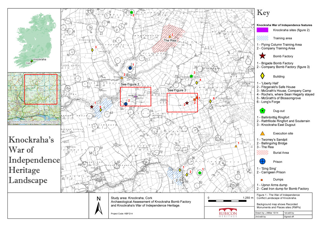
Rubicon sought to assess the extent the surviving Guerrilla War landscape in Knockraha through a combination of primary source research and liaison with those local history society members who had interviewed veterans. The aim was to identify and map as much of the conflict landscape as we could using GIS. In order to achieve this we broke the conflict landscape down into a number of identifiable sections, combining the locationary information with accounts, such as Military History Bureau Witness Statements. The type of features we covered are outlined below:
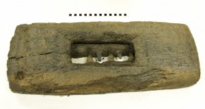
- Bomb Factories– Knockraha was the site of two, which mainly produced grenade casings. These were the Cork No. 1 Brigade Bomb Factory in Blossomgrove and the Knockraha Company Bomb Factory in Ballynanelagh. Local forges were used to assist in making machinery for both these factories, and both forges survive- the Moloney Forge in Knockraha village and the Long Forge in Killeena.
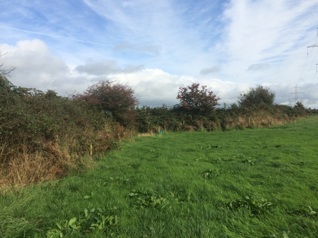
The site of the bomb factory in Ballynanelagh townland, looking ENE at the ‘kink’ in the townland boundary (Copyright Rubicon Heritage)
- Dug-outs and Dumps– An I.R.A. dug-out was located in the ditch of a ringfort in Ballinbrittig, and the souterrain at Rathfilode was the scene of a dramatic incident for the local I.R.A. as they looked for another. Another dug-out which could accommodate ‘six-men’ was located in Knockraha East. Supply dumps included those in Aghadull, where captured arms from H.M.S. Upnor and raw material for the Company Bomb Factory in Ballynanelagh were stored.
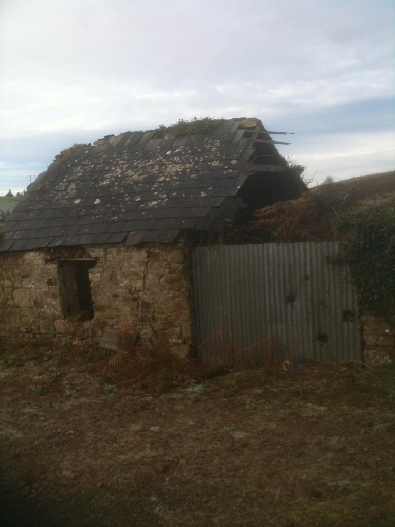
‘Liberty Hall’ where the Knockraha Company was formed in 1917 (Copyright Rubicon Heritage)
- Buildings– The most notable in the area is ‘Liberty Hall’, where the Knockraha Volunteers were formed in 1917 by Martin Corry and which still survives. The Fitzgerald farmhouse across the road in Ballinbrittig was an important safe-house, as was ‘McGrath’s House’ in Kilrussane and ‘Roche’s’ in Aghaduff, where Sean Hegarty, Officer Commanding Cork No. 1 Brigade, once stayed. The abandoned McGrath farmstead in Blossomgrove is where the Flying Column spent its early days, training in the surrounding fields. Longs forge in Killeena supplied support and material for the construction of the Company Bomb Factory. The majority of these buildings still survive in the landscape.
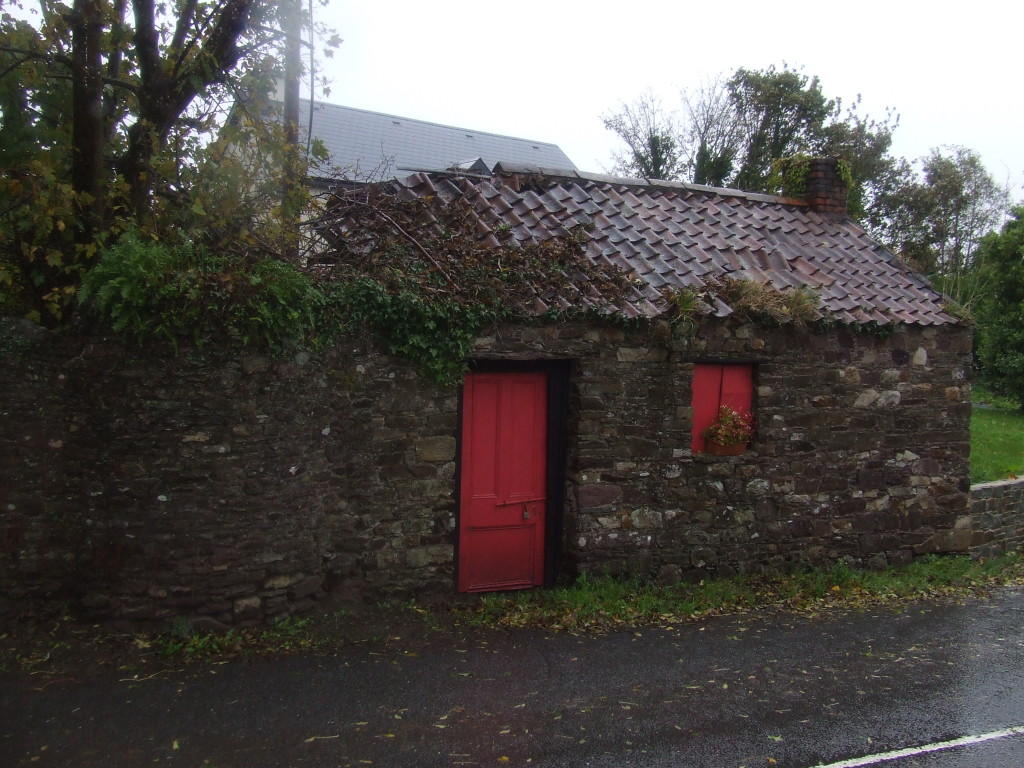
The house and forge of Edward Moloney, Governor of ‘Sing Sing’ Prison (Copyright Rubicon Heritage) 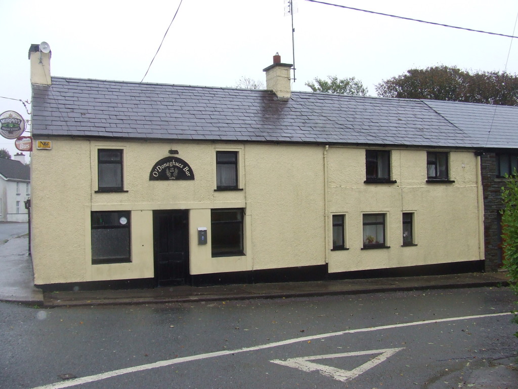
O’Donoghue’s Pub, Knockraha, formerly Canavan’s, where I.R.A. members went following the Clonmult Ambush (Copyright Rubicon Heritage) - Training Areas– The Knockraha Company initially trained around ‘Liberty Hall.’ Knockraha was also chosen as the location where the 4th Battalion Flying Column was formed and they appear to have initially trained in Blossomgrove.
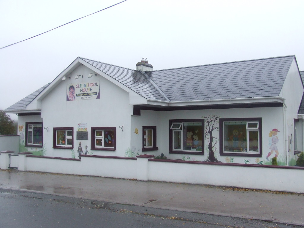
The schoolhouse, where Sinn Fein Courts were held during the War of Independence (Copyright Rubicon Heritage)
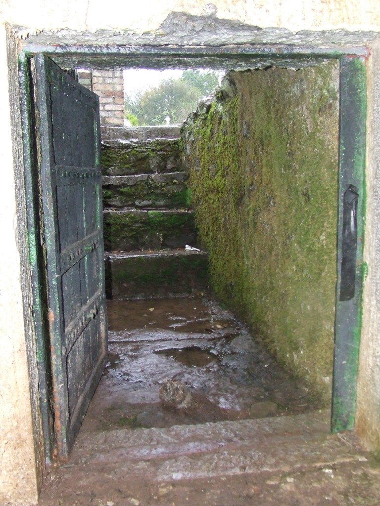
- Prisons & Places of Execution– Kilquaine Cemetery was the location of the notorious ‘Sing Sing’ Prison, a crypt where criminals and suspected spies were held by Cork No. 1 Brigade. Carrigeen in Knockraha townland was also used to hold prisoners. A number of execution sites have been identified in Knockraha. These include Twomey’s sand pit in Ballinbrittig, and Ballingohig Bridge where a British army man was reportedly executed. The most significant is the boggy-area in Kilquaine known as ‘The Rea’, where a number of executions and burials took place.
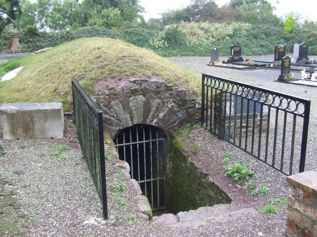
‘Sing Sing’ prison in Knockraha (Copyright Rubicon Heritage)
- Knockraha Village– The main street of the village is where the Knockraha Company assembled to drill each Sunday. The school (now a creche) was where Sinn Fein Courts were held. Canavan’s Pub (now O’Donoghue’s Pub) was a Flying-Column safe house and is the building where the only escapee from Clonmult went after that disastrous I.R.A. defeat (the worst in terms of loss of life for the I.R.A. during the war). The house where Edward Moloney, Governor of ‘Sing Sing’ lived also survives, as does the forge where he helped make material for the bomb factory. The Catholic Church was employed as a site where arms were stored.
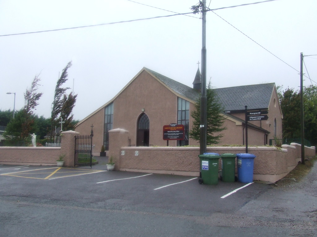
Knockraha Church, where arms were stored during the War of Independence (Copyright Rubicon Heritage)
The Decade of Commemorations presents archaeologists in Ireland with an opportunity to examine archaeological heritage that has previously been largely ignored (this includes Ireland’s Great War archaeology, see here). In the case of the War of Independence, may aspects of the ‘Guerrilla War’ landscape survive, but through both a lack of study and lack of recognition they are increasingly at risk. These landscapes can and should be mapped and studied in the contemporary landscape, beginning with archaeological studies at a local level throughout the country. Initiatives such as that embarked upon by the Knockraha Area Historical & Heritage Society provide a starting-point for local engagement and education which should be exploited. They also highlight the heritage preservation and tourism potential of this type of archaeology. The Society’s lead is an example that should be followed across the country if we want to provide a lasting archaeological and heritage legacy for the Decade of Commemorations.